Wednesday, August 31, 2011
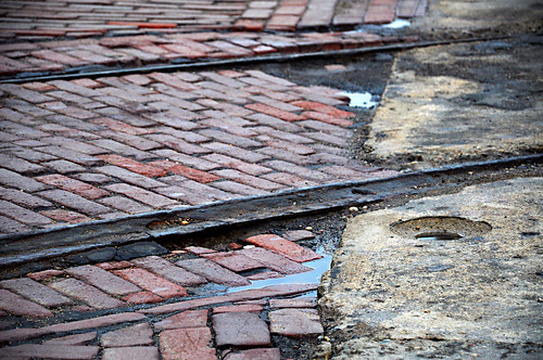
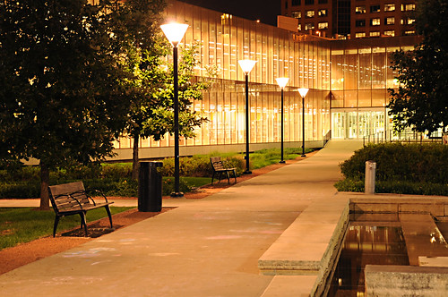
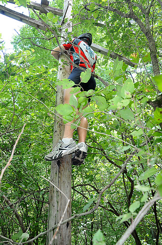
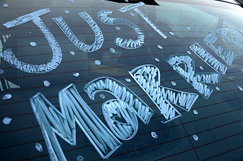
Project365: Day 242 - Streetcar Line
Tuesday, August 30, 2011
Monday, August 29, 2011
Project365: Day 240 - Juno
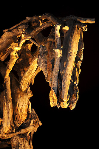
"Juno" by Debora Butterfield. Pappajohn Sculpture Park, Des Moines, Iowa.
Butterfield is one of my favorite sculptors. She has done over 1,000 of these horses, and each one is unique. She first constructs each sculpture from driftwood, branches, and logs. Once assembled, the entire piece is photographed, documented, and disassembled. Each individual piece of wood used is then replicated by bronze casting, and the piece is reassembled using the bronze casts. It is amazing how much the final bronze casts still look like real wooden branches.
Project365: Day 239 - Des Moines Skyline West
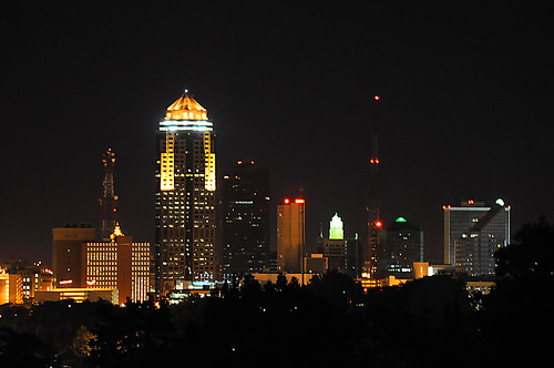
It is tough to make a photo of Des Moines' skyline from west of Downtown. Tall trees, bridges, or buildings, usually block the view. One of our friends just moved in to an apartment on the hill west of Downtown, and her balcony is above the treeline! I made this photo when we were over at her new place for her "welcome back to Des Moines" party.
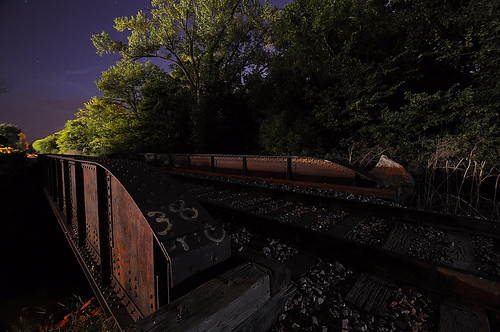
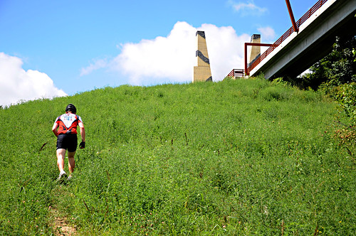
Project365: Day 238 - Central Iowa Trails
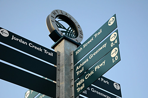
A bunch of these rather good looking signs have popped up around the Des Moines area to help bikers, joggers, walkers, rollerbladers, and really anyone who can read (sorry dogs) find their way around the excellent network of recreational trails.
Project365: Day 237 - Tractor-made Ice Cream
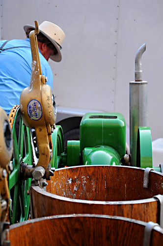
Homemade Amish Ice Cream churned with the help of a tractor engine. This was taken at the Valley Junction Farmer's Market right before we ate a bowl full of the very smooth, delicious ice cream.
Project365: Day 236 - Mantis
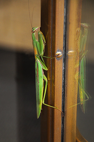
This little guy (actually not so little--almost 6" long!) was hanging out on the edge of the revolving door at my office in downtown. I had never seen a praying mantis this large before!
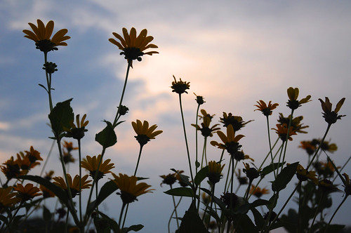
Project365: Day 235 - Field of Flowers
Project365: Day 234 - Downtown Library
This is still one of my favorite buildings of all time. It is just as beautiful at night as it is during the daytime.
Project365: Day 232 - Hefe "R" weissen
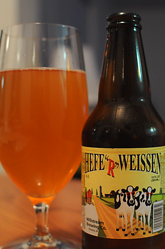
One of my new favorites for a couple reasons:
- It is tasty.
- It is brewed locally (Millstream Brewing, Amana Colonies, Iowa)
- It has cows in sunglasses.
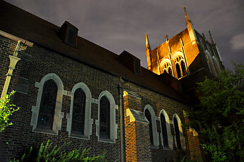
Projecty365: Day 227 - Mercy
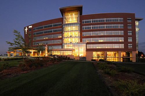
Mercy West Hospital in West Des Moines, Iowa. One of my favorite newer buildings in the Des Moines area.

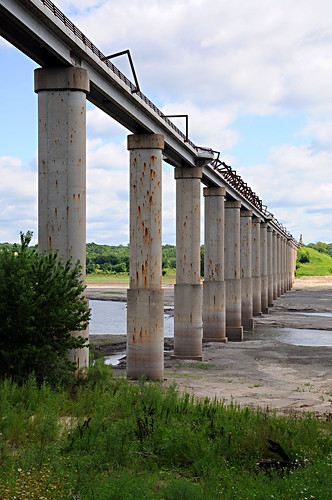
Project365: Day 225 - Geocaching on the High Trestle Trail
We tried for a multi-cache that eventually brought us down the hill underneath the impressive bridge, but it appears that the cache was likely washed away in the flooding earlier this year. The view of the bridge from down below is pretty amazing though.
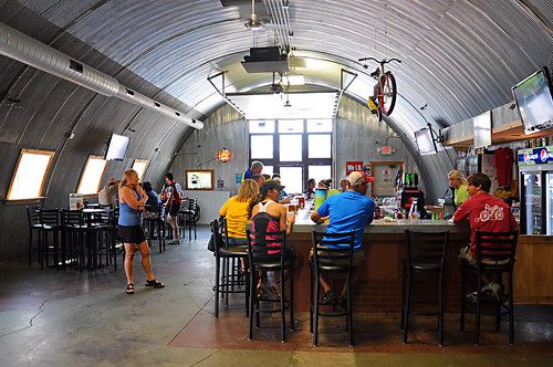
On our way back towards Slater, we stopped for lunch at the Flat Tire Bar right along the bike trail at Madrid, Iowa--perfect location! The patio and bar were full of cyclists stopping in for a break on a perfect day to be riding.
Friday, August 26, 2011
Project365: Day 224 - Iowa Corn, Part 2
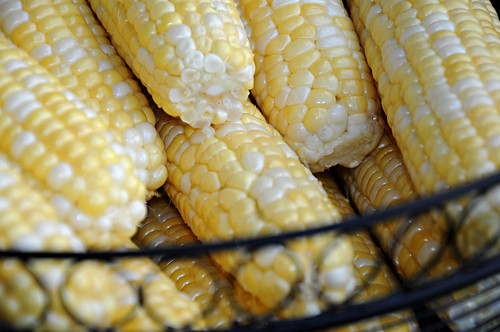
I took me until August, but I finally got to eat some delicious Iowa sweet corn this summer!
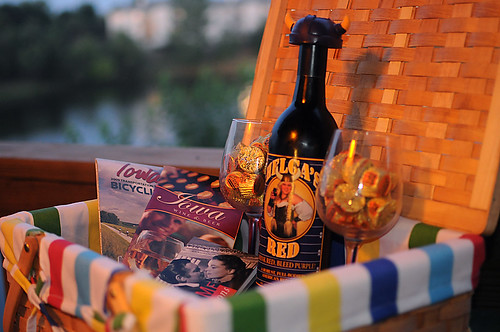
Project365: Day 213 - Date Night Basket
Wednesday, August 24, 2011
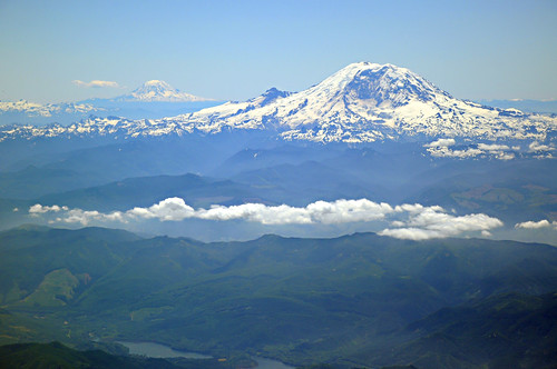
Project365: Day 211 - Heading Home
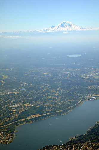
About 15 minutes into the flight at about 18,000 feet (almost 4,000 above Rainier's summit) we were able to see Mount Adams in the distance as well.
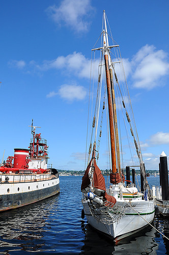
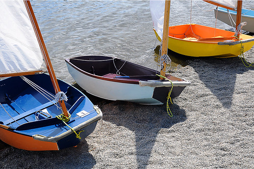
Project365: Day 210 - Lake Union, Geocaching, and the Locks
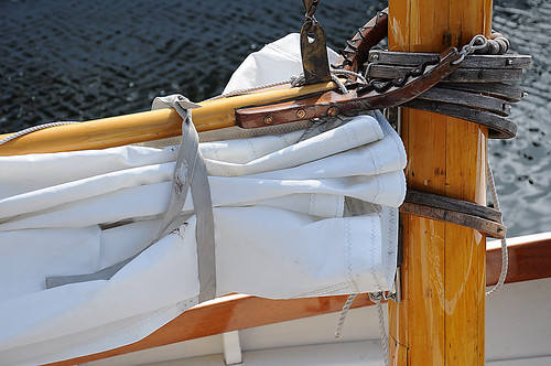
A large variety of boats, most still in use, are on display here--hand-carved canoes, old weathered sailboats, and even a restored steam-launch boat called Puffin.
The Center for Wooden Boats also offers sailing classes on Lake Union. As we were walking through the park, a youth class was preparing to head out onto the water. The sailboats they use for teaching the youth classes are small and charming.
After the Center for Wooden Boats, we walked up towards Ballard for the afternoon. As a geocacher, I couldn't go to Seattle and not pay a visit the The Lilypad--the headquarters of Groundspeak, the parent organization of geocaching.
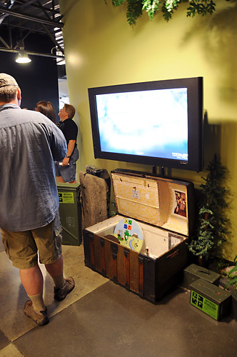
We got to meet a few of the Groundspeak "Lackeys", signed the log book for the official HQ geocache (that giant treasure chest on the floor), and had our photo taken in their photobooth and posted it on the wall. One of the coolest things to see during our visit was the TV screen on the wall above the cache. The screen displays a Google Map that jumps every 30 seconds to the last cache that was logged on Geocaching.com. It was very cool to watch it bounce all over the world as users logged caches.
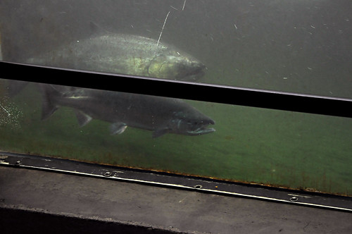
From the Geocaching HQ, we walked (through a terribly romantic industrial area) up to the Chittenden Locks. The Locks are the point of access for boats traveling between Elliot Bay and Lake Union/Lake Washington. It was established and is managed by the Army Corps of Engineers. When we arrived at the Locks, we first went into the viewing room underneath the dam. From there you can see into one stage of the salmon ladder that has been created to allow chinook, sockeye, coho, and steelhead salmon to migrate upstream in order to spawn in the small creeks the feed into Lake Union and Lake Washington.
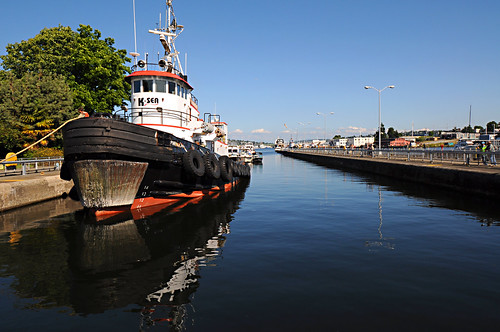
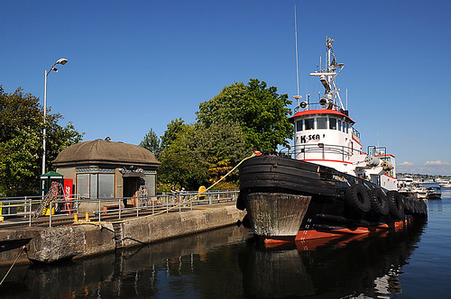
Shortly after we came up from the viewing area on to the top of the lock and dam, a tugboat and a few other larger boats began filing into the larger of the two locks.
Here's a time-lapse that same tugboat making the transition from Lake Union to Elliot Bay:
We hopped on a city bus back to downtown, which completed our bingo card for modes of transportation used on our trip:
- Airplane (MSP to SEA and back)
- Light Rail (airport to downtown)
- Ferry (SEA to Victoria)
- Monorail (Downtown to Seattle Center)
- Automobile (Seattle to Rainier)
- Streetcar (Downtown to South Lake Union)
- Bus (Chittenden to Downtown)
- Walking (absolutely freaking everywhere)
One more night in Seattle, then back to Minneapolis and "real life" once again.
Tuesday, August 23, 2011
Project365: Day 209 - Mount Rainier National Park
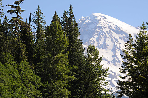
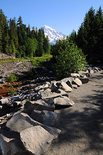
On the drive from Seattle to Enumclaw, we could see Rainier almost the entire time. Once we got closer to the park, however, the towering trees of the thickening forest obscured the mountain. We stopped at Kautz Creek, the first marked scenic viewpoint in the park, and were immediately reunited with an amazing view of Rainier.
Brittany made sure we got plenty of photos of the two of us throughout the day, starting right away at our first stop.
Kautz Creek is known for being a severe flooding hazard and routinely changing its course through debris flows, sometimes violently. Previous flows have changed the entire river path, destroyed trails, and even covered the main park road in deep piles of debris. Today it looked pretty innocent and tame.
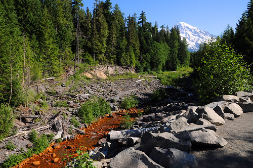
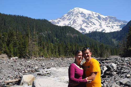
We continued further into the park to the Nisqually River. The fast-flowing Nisqually River is comprised of the meltwater from the Nisqually Glacier on Mount Rainier's south face. The milky color of the water is due to "glacial flour"--sediment that was picked up by the glacier during its movement. The glacial flour is a sign that the glacier itself, and not just the snowpack on top of it, is indeed melting.
At a narrow point in the river, a rough bridge had been placed to allow hikers to cross. A split log with a handrail on one side only and the water rushing underneath, this bridge was exciting to cross. Luckily it was very stable.
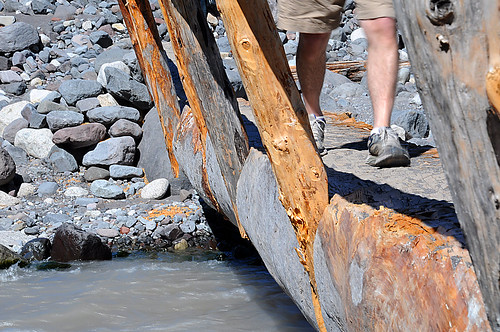
Another photo of us in front of Mount Rainier after successfully crossing the rustic bridge.
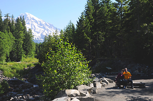
Paradise is the busiest and most crowded area of the park for a few reasons: it is easily accessible by car, it is the most developed area of the park, and it offers some of the best views of the mountain without considerable hiking effort. It gets so busy on weekends that the park offers a shuttle service from Ashford (outside the park) up to Paradise because the parking lots fill so fast. For this reason, we made a point of going to Rainier on a weekday and planned to arrive early enough to beat the crowds.
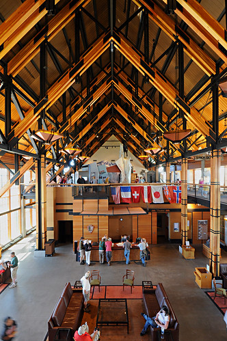
The visitor center at Paradise is relatively new (it replaced an older, smaller visitor center here), but is still a stunning example of the great architecture found in many of our National Parks. The large windows on the ground level each have large reinforced doors that close over them on the exterior to protect the building from the extremely deep snow that can fall here in the winter.
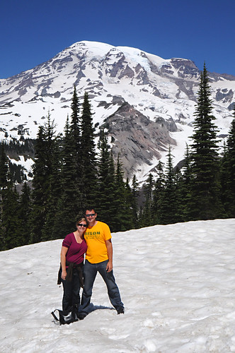
At Paradise, we had decided to hike on the Nisqually Vista Trail, one of the most popular warm-weather trails in the park. This trail is paved, relatively flat, and usually by late July is surrounded by a lush wildflower meadow. Because of above average snowfalls and below average temperatures this past year, the Nisqually Vista Trail was still snow-covered, but we walked it anyway!
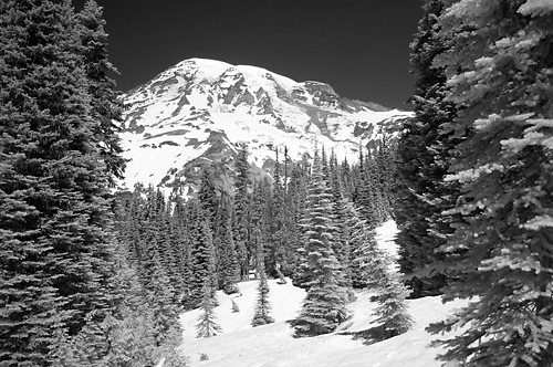
The bamboo trail markers in the snow indicated that we were standing on anywhere from 6 to 10 feet of snow at this viewpoint. As you can see, we didn't wear jackets on the hike. Yes there was still plenty of snow, but the temperature was 75 degrees. We both got a little sunburned on the trail from the bright sun reflecting off of the snow.
We arrived back at the Paradise visitor center just as the crowds were getting crazy, and in time to head down the road ahead of them again. Just outside Paradise is the Reflection Lakes area, which is pretty self-explanatory.
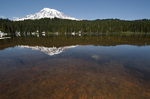
And pretty awesome. I slid down a snowbank and actually put my tripod into the shallow water at the edge of the lake for my photos there.
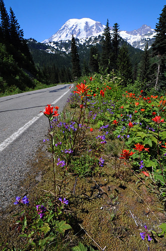
After Reflection Lakes, we started to go down in elevation as we entered Stevens Canyon. This elevation drop brought us below the snow line and into the wildflowers.
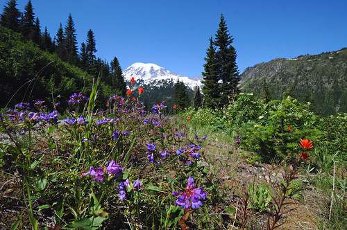
The Stevens Canyon Road was one of my favorite parts of the park to drive, though Brittany definitely did not care for the very long and steep drop off to her side of the car.
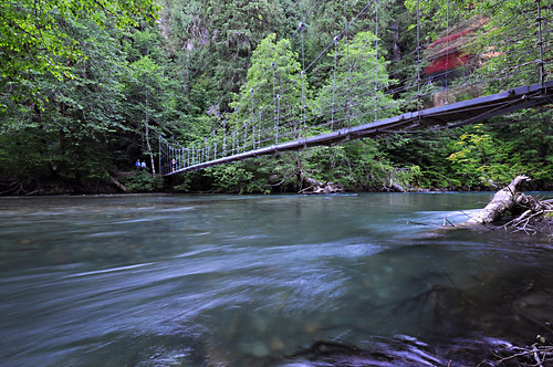
We stopped a periodically at some overlooks and waterfalls on the next leg of the road, but our next destination was the Ohanapecosh area. Ohanapecosh is the lowest part of the park at 1900' above sea level. The area is home to natural hot springs, a large camping area, and the Grove of the Patriarchs--an isolated island full of towering douglas firs, western hemlocks, and western red cedars. Many of the trees on the island are over 1,000 years old.
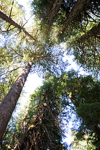
The entire loop trail in the Grove of the Patriarchs was beautiful and humbling. Even the single-file suspension bridge over the Ohanapecosh River out to the island was picturesque.
From Ohanapecosh there are two routes back towards Seattle. Doubling back the way we came into the park meant seeing the same sights in reverse and (worse) possibly having to drive in traffic with clueless tourists. Continuing in the same direction on the loop highway, around to the east and north faces of Rainier, gave us a full tour of the park. It also brought us to the Naches Tavern, a hole-in-the-wall bar and grill in Greenwood, for a tasty dinner before heading back to Seattle.